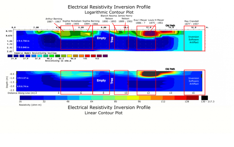
Electrical Resistivity Imaging (ERI)
Inexpensive, Non-Destructive, Fast
Streiff-Flynn Geophysics (SFG) uses ERI to image the ground. ERI is a geophysical method that records variations in ground resistivity created by the different subsurface materials present. An image of the ground is created from these resistivities.